Thursday, May 9, 2024 May 9, 2024
79° F Dallas, TX
Advertisement

FrontBurner

A Daily Conversation About Dallas

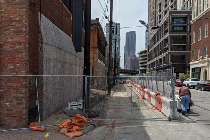
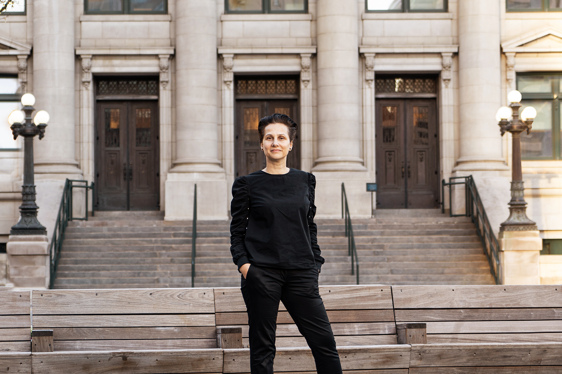
Amy Meadows is the CEO of Parks for Downtown Dallas, the nonprofit foundation that has partnered with Dallas and its parks department to create more greenspace in the city’s urban core. The foundation has been tasked with developing four downtown parks, which will be owned by the city.

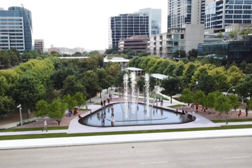
Two of those parks have opened in the last several years. The Dallas Morning Newsarchitecture critic hailed the technology-oriented West End Square as “a model for how the delicate relationship between the urban landscape and our connected way of living might be navigated,” and Pacific Plaza beautifully replaced one of downtown’s many unnecessary parking lots with a lawn, pavilion, and ample shade from the Texas sun. Carpenter Park, in the works now on the east side of downtown, will be the largest downtown park. Its 5.6 acres are set to include rescued public art plus a basketball court and dog park, along with other amenities. Harwood Park, where crews will break ground later this year, is on deck.

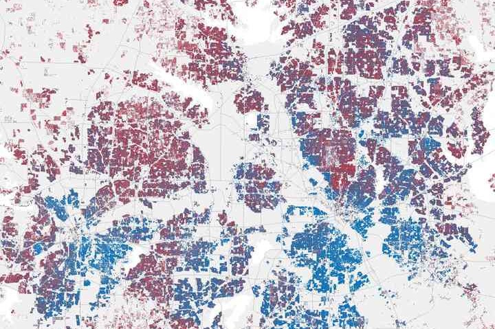
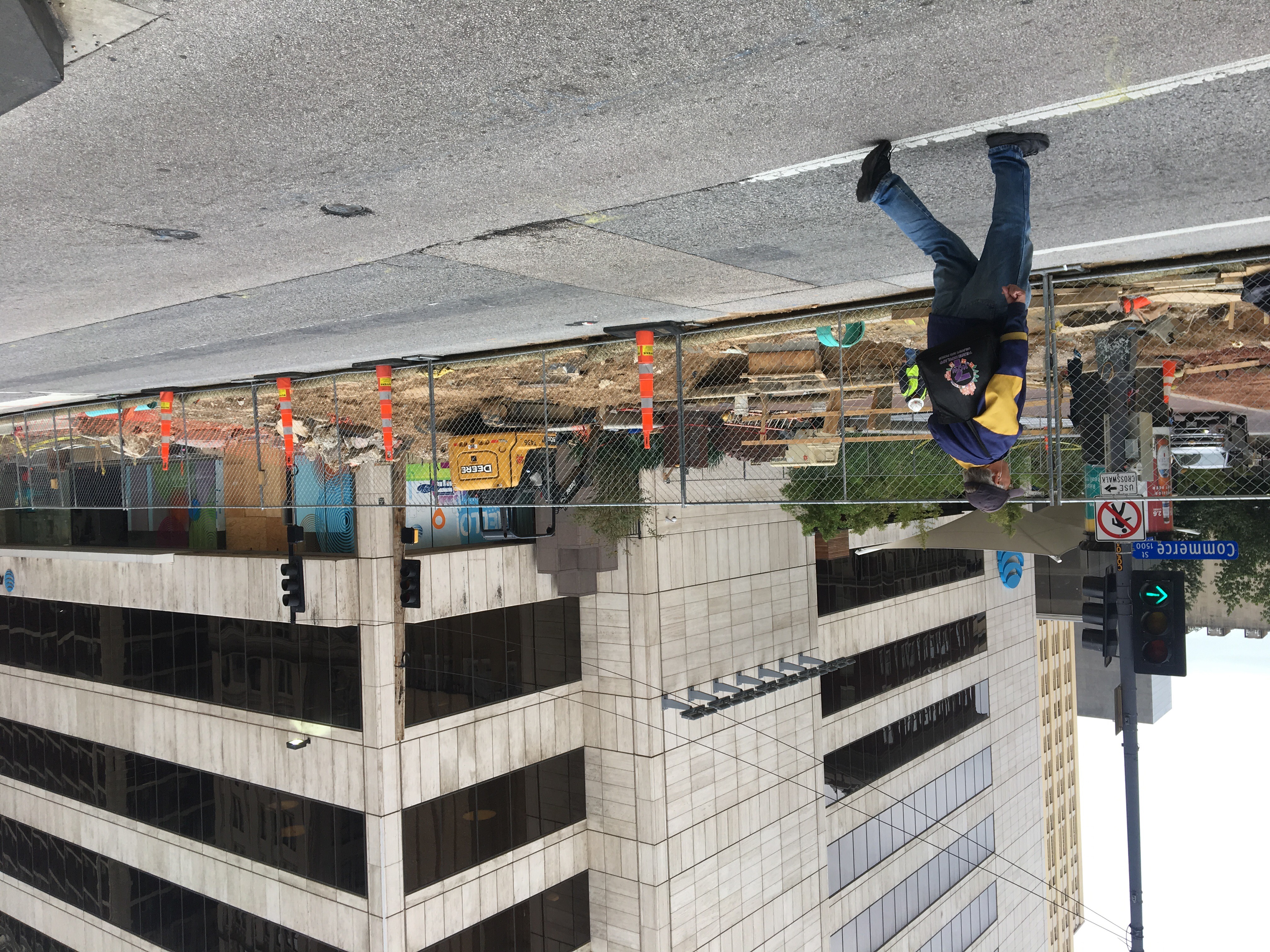
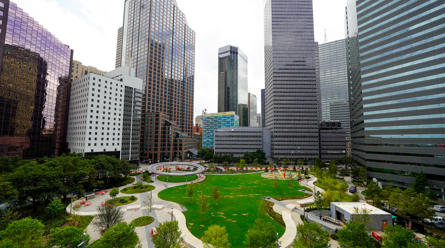
The development of these parks, combined with the success of Klyde Warren Park (owned by the city and privately managed by a separate foundation), have accompanied and helped spur a transformation of the city’s urban core. Downtown boosters say the COVID-19 pandemic hasn’t thrown that revitalizationoriginating in part from Boeing’s 2001 snub of our then-dreary downtownoff track. Parks for Downtown Dallas is thinking long-term, anyway. “We were trying to design and build parks that are 100-year parks,” Meadows says. “They’re going to be here for a very long time.”

If anything, the pandemic made clear just how necessary parks are to making downtown more walkable, more liveable, greener and much coolerliterally. “We’ve heard from a lot of people living in high-rises downtown that these parks were really wonderful respites during COVID,” Meadows says. “These parks are more desired now than they were before.”

I got on the phone with Meadows to talk about, among other things, how to judge whether a park is “working” and how the fate of downtown’s largest greenspace is tied to the future of I-345. This interview was condensed and edited for clarity.

We know it’s been a while since you’ve seen this feature. And we also know that the perambulating difficulties across the city of Dallas haven’t let up. So we’re re-launching Dallas Hates Pedestrians, starting in Deep Ellum. This is a classic example of what this feature has tried to raise awareness of: sidewalks are not meant to be rental space for construction. This image was taken at Good Latimer and Elm Street last month, but it has been under construction for a while. The construction has swallowed the sidewalks, with the Epic on the north side of the block and the smaller storefronts on the south. Here is how Google Maps captured it in February of 2020:

The Texas Department of Transportation believes its redevelopment of Interstate 30 near downtown aligns with how President Joe Biden plans to spend the federal government’s mobility money. So the state is going after a lot of it.

The federal Infrastructure for Rebuilding America Grant, or INFRA, is a $900 million grant program targeted at projects that will boost the economy and create jobs. In past administrations, that has meant highway expansions. But after his confirmation, Transportation Secretary Pete Buttigieg reshaped the program’s criteria to prioritize projects that featured components to improve racial equity and the environment, favoring those that took comprehensive, collaborative approaches to inform their plans.

TxDOT believes its vision for the Canyon checks a lot of the boxes the feds are looking for. It attempts to restore the street grid the freeway tore apart when it opened to traffic in 1965, giving the Cedars more direct connections with downtown. (TxDOT’s argument: “While the CBD and areas north of I-30 have enjoyed decades of growth and dense commercial development, the area south of I-30 has struggled to thrive, with a fragmented mix of underutilized and underdeveloped parcels, falling far short of the potential that its centralized location would support.”)

The plan features bridge crossings at Lamar/Botham Jean Blvd., Griffin, Akard, Browder, Ervay, Harwood, and Cesar Chavez. Those are planned to include Complete Street elements like wide sidewalks, protected bike lanes, and greenspace. The overhaul frees up about 14 acres of land for private redevelopment, mostly by removing ramps and surplus frontage roads. There are plans for connections to DART’s light rail as well as the planned high-speed rail; that station will be built on the western end of the Canyon. The state is also leaning on its plans for pedestrian-friendly infrastructure and green space to lessen the environmental impact of the freeway.

Too, TxDOT is leaving open the possibility of up to four deck parks to connect downtown with the edge of South Dallas; that money will have to come from other sources. While the design will vary somewhat, Klyde Warren Park and the deck park over Interstate 35 in Oak Cliff cost about $60 million total; the infrastructure itself was $47 million while the park additions added another $13 million.

The state is asking for $146 million from the INFRA program, which would pay for about a quarter of the entire project. The feds haven’t released the full list of applications from other states, but that ask is more than all but two applications submitted for the program in 2020. (California wanted $220 million for a port upgrade and Louisiana requested $185 million for the second phase of its expansion of Highway 1, which extends diagonally across the entire state. Louisiana got $135 million, but California wasn’t awarded the grant for the port.)

Transportation

A New Plan for Tearing Down I-345

Peter Simek
|

Tearing down highways is long and difficult work, particularly in a city with a culture that is so wedded to the automobile. Consider this: it has been five years since the Texas Department of Transportation released the CityMAP study, which analyzed the implications and logistics around tearing down Interstate 345, that little strip of connective concrete that cuts off Deep Ellum from downtown. D Magazine devoted an issue of the magazine to the I-345 removal idea way back in 2014. And can you believe it has been nearly eight years since urban planner Patrick Kennedy proposed the then-radical concept in a column in D? Since then, highway removal efforts have gone mainstream. The country’s new transportation secretary is even using them as policy talking points.

Enter a new study that attempts to kick Dallas’ highway removal project into a new gear. It refines some of the plans outlined in CityMAP. This 90-plus page report is being called the I-345/45 Framework Plan (admittedly not as catchy a title as CityMAP), and it was developed by the Toole Design Group, LLC, an engineering and urban design firm that helped plan the I-375 highway removal in Detroit. It attracted an extensive list of partner organizations and individuals and produced the report following a substantial amount of public input. This plan refines the CityMAP study in three key ways:

  1. It provides a more holistic view of the reasons for removing I-345.
  2. It dives more deeply into how such a removal would affect mobility, including a fascinating analysis of how a reconstituted street grid could handle traffic.
  3. It offers a land use vision for how to maximize the potential benefits of the highway removal.

Now, full disclosure: the report is also dedicated to the memory of the late Wick Allison, the founder of D Magazine, who had been a champion of the I-345 project since Kennedy first raised the possibility in our pages. The Coalition for a New Dallas, an organization co-founded by Wick, is also a driving force behind the completion of the “Framework Plan,” and tomorrow the Coalition is hosting an online symposium that will both present this new plan and outline its policy priorities heading into this May’s city council elections.

The timing of the report’s release is significant for another reason. There is a lot of transportation planning happening in and around downtown Dallas right now, and top city and regional planning officials want to plan all three major downtown projects—Dallas Area Rapid Transit’s D2 downtown subway connection, the I-30 canyon rebuild, and I-345—in tandem. At a recent council briefing, Michael Morris, the transportation director of the North Central Texas Council of Governments, said that TxDOT expects to complete a I-345 traffic study sometime soon.

The Toole study—which I will refer to as the Framework Plan for the rest of this piece—offers an important counterpoint to that TxDOT study. It provides broader vision and technical comparisons to help check whatever TxDOT’s assumptions turn out to be.

Let’s dive into some of the details:

Advertisement

Editor’s Note: The Dallas City Council unanimously approved the resolution on Wednesday afternoon, which frees DART to pursue the project’s federal funding. It has to work on other options for the project’s east side. You can read about that vote—and what it says about Dallas’ transit priorities—right here.


The Dallas City Council has a big decision to make today. Does it want a downtown subway or not?

The subway would double capacity while giving the light rail system a relief valve in the event of a derailment or some other disruption, as the current system bottlenecks on the single rail line through downtown. Dallas Area Rapid Transit says it needs a thumbs up or down during Wednesday’s meeting from Council to meet deadlines to pursue $800 million in federal funding to help pay for the project, which is known as D2. This is the resolution council will be voting on.

But DART will need $1.7 billion total, and the feds will pay for only half of it, which means it has to spend a lot of money to get those federal dollars. This project has been a key part of the transit agency’s capital plans since 2017, when the Dallas City Council passed a resolution supporting the below-ground alignment. It was a hard-fought battle. DART originally wanted the track to be at-grade through downtown, which would have required significant eminent domain and disruption.

Council and other groups fought for it to be built as a subway, which has more than doubled the price. It is a decision that will likely affect DART’s borrowing power through at least 2035. (But the agency will have enough to cover its other large projects, including the overhaul of the bus system, the Silver Line rail into Collin County, and continued maintenance.)

The D2 line would go from near Victory Park to the Perot Museum of Nature and Science south into downtown. It heads east along Commerce as it makes its way into Deep Ellum. There are four planned subway stops, which DART believes are significant development opportunities. It emerges as a surface line on Good Latimer. When it reaches Swiss Avenue, DART wants to put an above-ground “wye” junction, a Y-shaped confluence of the rail lines.

Most of the concern springs from interests on the east side of the alignment. The Deep Ellum Foundation, the group of business owners that operate the neighborhood’s Public Improvement District, hates how the subway emerges to join the street. Major landowners in Deep Ellum and the east side of downtown, particularly commercial and residential developer Westdale, have similar problems with it. They believe this will damage the urban fabric in a key neighborhood. Good Latimer is a main way in and out of the district, so how will having a surface rail line affect traffic? What about walkability? And the wye junction requires a fair amount of land. Will this eliminate future development? (They did get one win; the wye junction was originally planned for the denser Elm and Good Latimer intersection.)

“While we understand the regional importance of expanded core capacity and the need for a wye junction, the D2 project’s alignment and current plan to resurface to be at-grade along this corridor will disproportionately hamper area development, connectivity, and traffic,” wrote Stephanie Hudiberg, the executive director of the Deep Ellum Foundation, in a letter the organization sent to DART.

The west side is a different story. Developers in downtown proper are in favor of the project, as is Downtown Dallas Inc. But they need clarity. A subway changes how everything moves forward; they don’t want to plan for something that doesn’t materialize.

“My stakeholders want a decision,” said Councilman David Blewett, who represents downtown and Uptown. The vast majority of D2 is in his district. “If we’re not going to do it, let’s tell our people we’re not going to do it. We approved this in 2017, and we’re still screwing around with it. We’re harming the business community.”

Other concerns are more philosophical. This is a reliability project. While it does add capacity to DART’s line, it does not add new service areas or increase frequency under normal circumstances. It doesn’t pay for new trains or any other operational uses. The sorts of major disruptions that D2 would alleviate are rare. In the past year, there has been only one derailment, which backed the trains up about four hours. Meantime, there are still loud calls for improved service in southern Dallas, and this project to benefit the region will be housed in downtown Dallas.

Politics

New Maps Detail Neighborhoods’ Political Divides

Peter Simek
|

We’re used to talking about red and blue states, and about neighborhood divides centered around income inequality and the lingering legacy of racial segregation. But to what extent do these two things overlap? Do social economic and demographic factors create red and blue neighborhoods? According to a new study by two Harvard researchers, the answers is they do.

Jacob Brown and Ryan Enos sorted information on 180 million U.S. voters and attempted to map their political divisions on a neighborhood scale, publishing the results in Nature. The researchers don’t know, of course, how people voted in the recent election, but they crunched the data by analyzing public data like demographic information, voter registration, and whether voters participated in party primaries. What they found is that the country’s political divides extend into neighborhoods, and, in some case, even manifest on a block-by-block basis.

In some ways, the broad outlines of the maps aren’t anything new. Hand a red and blue crayon to anyone who pays close attention to local politics and ask her to color in the the political affiliations of the neighborhoods, and you might end up with a map like the one of DFW pictured above. But this data drills gets so granular that it manages to quantify some eyebrow-raising results. For example, as  the New York Times reports:

Publications

She Came to Fix the Parking

Peter Simek
|
Andreea Udrea
Photography by Ethan Good

Andreea Udrea isn’t your typical Dallas city staffer. The Romanian-born urban planner studied for her Ph.D. at the University of Turin, in Italy, and spent the first half of her career working in Europe. She taught at the Ion Mincu University of Architecture and Urbanism in Bucharest; helped draft a plan at Bucharest City Hall to remove cars from the historic city center; and founded a research initiative into the life and work of Cincinat Sfintescu, the founding father of Romanian urban planning. Then, in 2015, Udrea made the unlikeliest of career changes: spurred partly by family concerns, she took a job with the city of Farmers Branch.

I first heard of Udrea when I called Oak Cliff Councilman Chad West in November to ask about the city’s ongoing reform of its sorry parking regulations, which the councilman initiated early last year. When he was still chair of the Council’s Housing Committee, West led something of a crusade to overhaul the city’s byzantine permitting process. One city staffer I talked to estimated that 75 percent of the permitting department’s time is spent calculating parking requirements. I was surprised when West told me a quiet catalyst behind the reform movement was a member of the city’s own bureaucracy.

“She’s fantastic,” West said of Udrea, who by then had taken a job in Dallas. “She’s been unleashed on this without the constraints they put on their senior planners.”

For the first hour or so of Tuesday’s meeting of the Dallas City Council’s Transportation Committee, council members listened as the region’s top transportation official and the assistant city manager who oversees transportation discussed the need for a more integrated approach to long-range planning.

They proposed an approach to transportation planning that allowed for other city investments and services – like improved traffic signals, reconstituted streetscapes, and expanded access to high-speed internet – to be incrementally built into the system. The idea was to design each transportation project not as a single, standalone investment, but as a component of a broader network of iterative improvements.

Then, the council pivoted and nearly killed the Oak Cliff Streetcar, a pilot trolley line that the city has long hoped will someday evolve into a modern streetcar network covering downtown and the surrounding inner-city neighborhoods. It was a paradoxical juxtaposition of planning philosophies and something of a case study in what works – and what doesn’t work – with city planning in Dallas.

Council members are understandably frustrated that the Oak Cliff Streetcar is leaking money. The streetcar connects the far southwest corner of downtown at the Eddie Bernice Johnson Union Station with the Bishop Arts District. It is short nearly $1 million of its $2.3 million annual operating budget. Staff proposed the council draw from the city’s general fund to cover the gap, but only North Oak Cliff representative Chad West was vocal in supporting that idea; the streetcar is in West’s district. In the end, the council voted to delay action – but not before the committee kicked the tires on giving up on the streetcar altogether.

Advertisement

Good news for the I-345 removal proponents: the federal government is speaking the same language. In December before Congress recessed, more than two dozen Democratic senators signed onto then minority leader Chuck Schumer’s Economic Justice Act, a $435 billion spending bill that included a pilot project for removing highways that decimated communities of color in many major American cities.

The bill, if it’s passed, allots $10 billion over five years to tearing out the freeways and creating community land trusts to help manage land use after the structures are gone. The bill refers to these highways as “infrastructural barriers.” And I-345 is certainly that: an elevated mile-plus of concrete connective tissue between two freeways that divides downtown from Deep Ellum and the Farmers Market. Removing it would free up about the same total acreage as Fair Park, creating opportunity for housing, jobs, and other resources if the city can get the land use right.

The bill anticipates that challenge. As it’s written, local governments would be prioritized if they enter into an agreement with nearby residents to establish an anti-displacement policy or a land trust to help ensure that the removal of the highway won’t re-traumatize the community. That’s a significant inclusion because it would help communities have greater control over how the land around the highway removal is developed.

“Every highway teardown project will be a little different, have different political and market conditions, and these federal tools will have to be evaluated for whether they are appropriate,” says Patrick Kennedy, the DART board member and urban planner who first raised the possibility of removing I-345 about a decade ago.

The federal grants created by the bill would help pay for outright removal or a retrofit as long as it “enhances community connectivity and is sensitive to the context of the surrounding community.” The grants could help pay for replacing existing highways with a new facility or “other transportation improvements that address the mobility needs of the community.” The bill allows for the feds to pay for up to 80 percent of the project. For I-345, burying it below grade is also an option being explored.

The city of Dallas owns and maintains about 4,400 miles of sidewalk, but only 1,200 of those miles are undamaged or unobstructed. A Washington, D.C.-based nonprofit that judges how safe cities are for pedestrians says Dallas is more than twice as dangerous as the national average, scoring us just outside the 20 most unsafe cities for walking in America.

In considering parking requirements for proposed developments, the city only takes into account what it means for people in cars, not giving any special favor to projects that may encourage the use of public transit or actually reduce the need for a vehicle. Meanwhile, about half of all fatal and severe vehicular crashes occur on just 8 percent of Dallas’ streets, split between the denser core of downtown, Uptown, and Oak Lawn and the high-speed, six-lane arterials you can find all over town. In 2019, 174 people died in traffic-related incidents and another 920 were seriously injured.

These statistics come from the city’s first-ever mobility plan, a project that has been in the works since the Department of Transportation was reorganized, in 2018. Until now, the city has not formally attempted to account for how transportation policies affect pedestrian safety, as well as land use and economic development. Back in 1991, the city considered the very bad idea of widening Harry Hines to eight lanes through the Medical District. By contrast, this plan calls for the opposite: traffic-calming measures where possible and improved infrastructure to make it safer for folks to get around without a vehicle.

This mobility plan, which was unveiled yesterday in a Transportation and Infrastructure Committee meeting, is called Connect Dallas. It identifies some of the city’s transportation problems and provides guidance to prioritize spending on projects that will make it easier and safer for people to walk, bike, and use public transportation. “It really lays out the foundation for other elements such as housing, economic development, and equity and how all of them connect together,” said Majed Al-Ghafry, an assistant city manager. He called it “the framework for how we move forward … in terms of funding strategy.”

Parks

A Better Look at That New Klyde Warren Park Fountain

Tim Rogers
|

Last week, when it was announced that Nancy and Randy Best had donated $10 million toward the erection of a new “super fountain” in Klyde Warren Park, our own Zac Crain ridiculed the idea. Seeing the rendering of the fountain that was released at the time, I agreed with Zac. It looked terrifyingly out of scale. The brilliance of Klyde Warren is that it brings people together in a comfortable human-sized setting in downtown Dallas, a place that has for so long been hostile to humans. This thing, it appeared the opposite of that. Then the Morning News wrote an editorial that must have made its architecture critic, Mark Lamster, cringe. [Update 1:35 p.m.: 15 minutes after this post went up, Lamster published his thoughts on the fountain, though he hadn’t yet seen the images we are publishing here.] In part:

Yes, this project is flashy, splashy and over-the-top. A “super fountain” that will shoot water 95 feet high choreographed to music and colored lights could become the most Dallas thing in Dallas. Like big hair and 10-gallon Stetsons, it makes a statement. Supporters say it’s destined to become Dallas’ “blimp shot” — an iconic feature of the skyline.

But we’re not afraid of big, bold statements. In fact, we encourage them. The donors and developers in our city who can afford to spray out $10 million didn’t get where they are without making bold moves. Dallas is a city of big hats, big ambitions, big money, and now big fountains. We say bring on the dazzle.

We say bring on the outdated clichés and the pitchforks to rend our flesh! Yippee!

Good Public Transit

How Urban Planning Consultants Can Shape the Future of Dallas

Peter Simek
|
Image
Munn Harris Architects

Would you rather bring the family to a restaurant that offers you a few pages of menu items or a restaurant that only makes two or three dishes? Probably the former, right? Now what if the first restaurant had a terrible health department record, was panned by every dining critic in the city, and takes an hour to get the food on the table—but the second restaurant has a Michelin star?

Different story.

This is, essentially, the game Dallas Area Rapid Transit played this summer when it surveyed Dallas residents about its planned bus system overhaul. DART has long insisted that Dallas residents favored a bus system that covered as much of the city as possible. After all, whenever the agency threatened to change a bus line, riders pushed back. And when DART asked riders, non-riders, and other stakeholders in its survey whether they preferred a system with broad coverage over one that focused on increasing ridership, 55 percent said they wanted coverage.

But then DART asked the question again in a different way. Would Dallas residents prefer a short walk to a bus stop followed by a long wait for the bus, or a long walk to the bus stop followed by a short wait for the bus? The results flipped. Forty-seven percent of respondents said they preferred the long walk and the short wait, while another 29 percent said just make the whole damn hassle with the bus go as quickly as possible.

In other words, 76 percent of the respondents preferred the ridership-oriented, high-frequency bus network model. The question just had to be asked in a way that made it clear that they were choosing between quality over quantity.

Advertisement