
I made maps! More maps! This time in simplistic cartoonish form.
Here is downtown Dallas and vicinity highway system overlaid on top of an aerial which I’m excluding to prevent distraction:
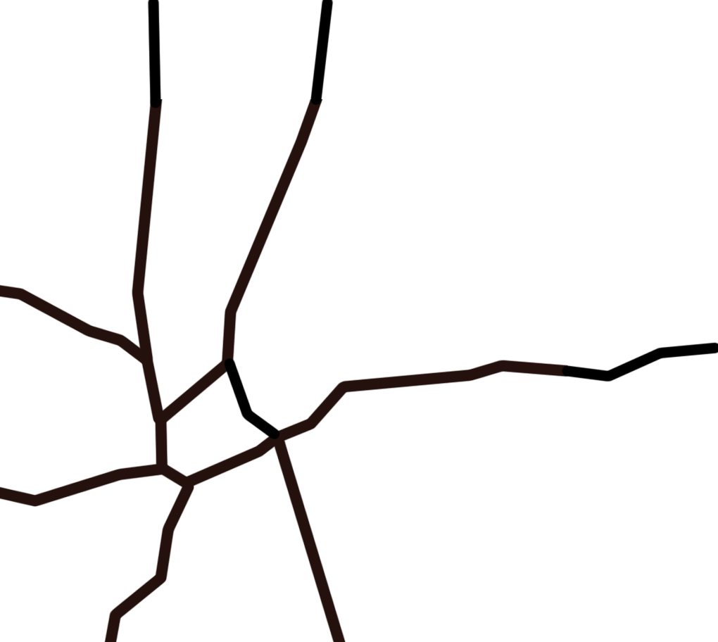
Below is what 345 tear-out would do:
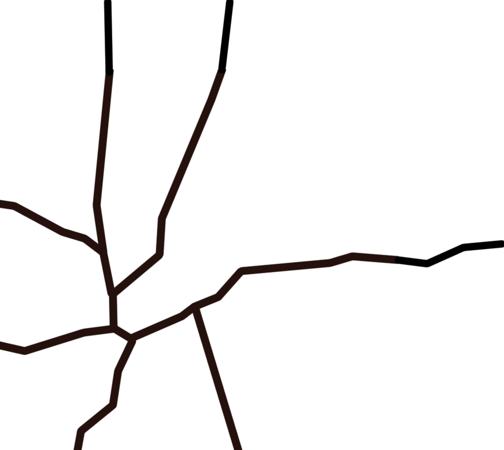
Ghasp! That seems terrible. It doesn’t connect two lines! We can’t drive straight! And fast!
Well, let’s think about it a different way. Many seem caught up in the idea that 75 is heading north-south, woodall-rodgers goes eastish-westish, and 345 goes north-south, so therefore, 345 must be the same road as 75! That’s science.
We seem to be a bit too hung up on the curve from 75 to WR. So for the sake of argument, what if we pretended that was straightened out a bit. Because, as we know, no highway on earth curves.

OK. Now what?
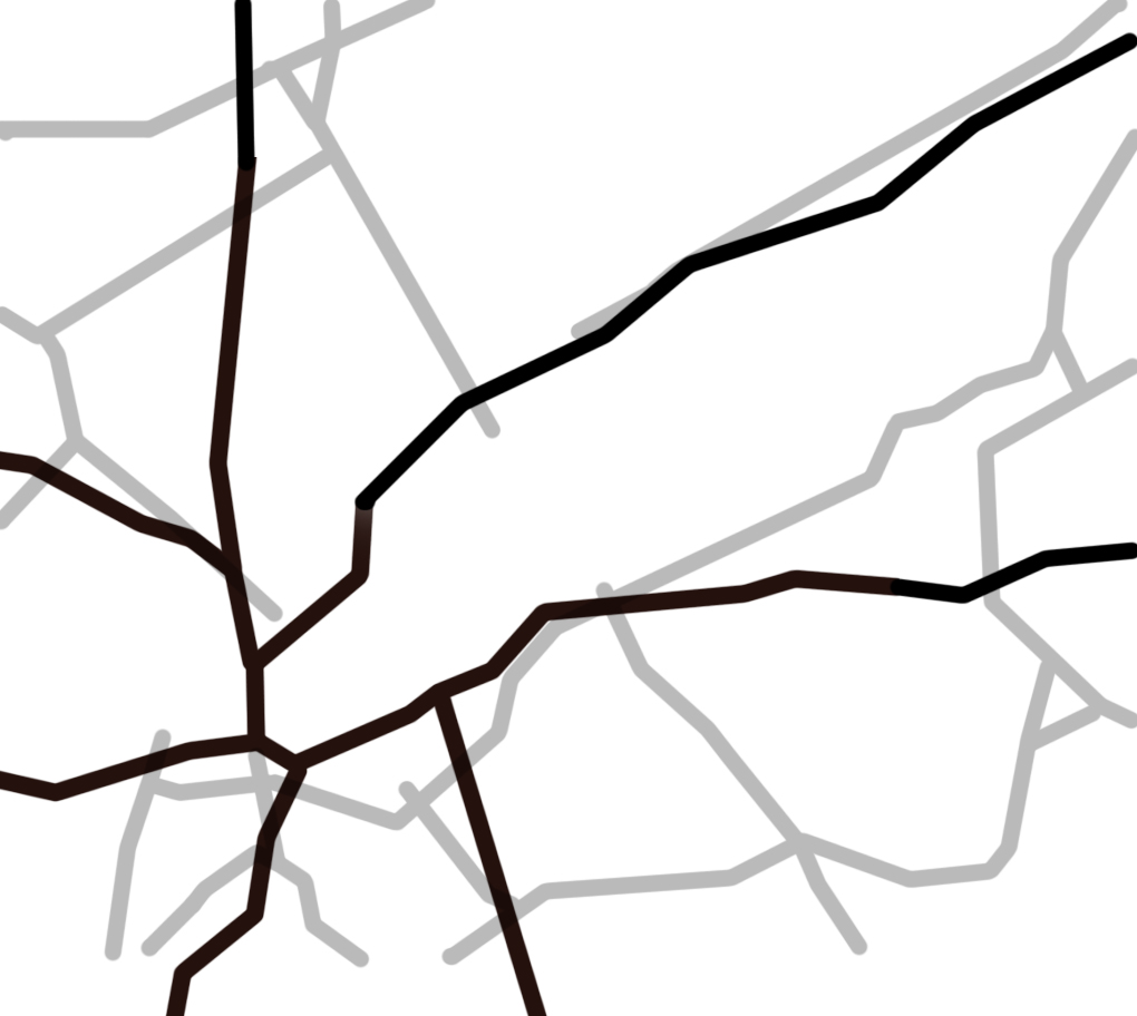
Here’s Manhattan as it exists today at the exact same scale, except rotated about 45 degrees clockwise for rhetorical effect. The gap, is where the West Side Highway was removed due to failing structure and replaced with a surface boulevard:

Here’s Dallas sans 345 overlaid upon rotated Manhattan. Think of our West Side Highway boulevard “gap” as Klyde Warren Park in the sense that KWP : West Side :: Dallas : Manhattan. All things exist on a gradient.
Manhattan has a big park towards its “top” you may have heard of:

A New Dallas has a great park and amenity at its “top,” we call it White Rock Lake:

Below is what Robert Moses proposed for Manhattan, with the West Side Highway that was built and two cross-town connectors, never built thanks to citizen activism that prioritized things like local economic and social networks and neighborhoods:

And now here is Dallas as it exists today and Manhattan of Moses’s sermon on the mount. All we need to do to realize it is turn Greenville Ave into a cross-town connector and we. are. GOLDEN.

This is your daily public service announcement that the establishment isn’t always right and that the cities that are world-renowned today for a variety of reasons, particularly livability plus economic activity like Vancouver, NYC, and Copenhagen began deprioritizing the car, car-dependence, and car-based infrastructure that coerces it back in the 1960’s in a variety of ways. CPH began removing parking lots and converting streets to pedestrian ways. YVR never allowed freeways, as they had a plan which looked much like Moses’s to criss-cross downtown island with freeways (which incidentally would have half the car capacity of the current YVR downtown street grid). And NYC had little old Jane Jacobs.
Like I said yesterday, it’s time to start thinking bigger about what Dallas is in fifty years as well. (one sentence graph)
I specifically mention a variety of cities with a variety of unique aspects and densities because I’m not saying Dallas should be like New York. I’m merely using this as an example to show that the world doesn’t end without high-speed cut-through traffic. It will actually get a whole lot brighter. No, it won’t be New York. Instead, it is the grid that will allow the coming together of Dallas citizens to exchange ideas, goods, services, laughs, and love, that allows Dallas to be the best Dallas that it wants to be. That it can be. That is, if it is allowed to make up its own mind with a bit less say from outsiders.
Nobody. Nobody today takes Robert Moses’s side vs. Jane Jacobs in the fight to build cross-town highways through Manhattan. Why? Nobody wants to be on the wrong side of history. Well, maybe a few. But without vision, it’s far easier to take the side of status quo, inertia, and fear of change. I prefer roads less traveled.

