
I was thinking about making much longer, more elaborate posts about these two diagrams, but instead I’ll let them speak for themselves (more or less). Early next week, I’ll have some good stuff for downtown Richardson. Until then…
—————–
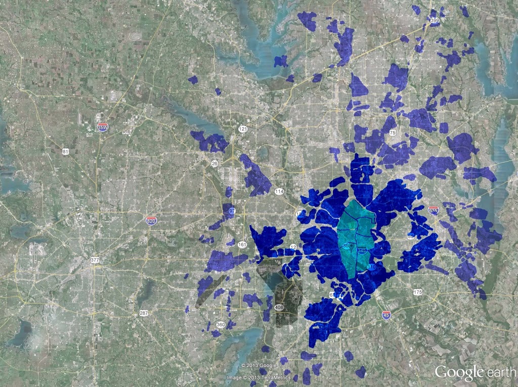
First, is an aerial map of DFW. The other day I posted a graphic showing Madrid metropolitan area overlaid upon this same aerial. I did so because Madrid has a similar metropolitan population to DFW, 6.3 million to 6.4 million. Except Madrid has about 20 times the density.
Speaking of density, here is Madrid again (representing 6 million people and change) except not at Madrid’s current size, but blown up to the scale of density that Dallas was in 1950. In other words, if Dallas developed at roughly the same density it was in 1950, it would look something more or less like this, or take up 1/14th of the land area it currently does. That would mean more land allocated for nature and agricultural production in close proximity to residents. How far do we have to drive to find either of those things at present?
If we want density, and the amenity that density affords, we need an infrastructure that favors density. That favors the short-trip over the long-trip.
———————
I had several graphics lined up to support the argument that Ross Avenue could and should be our scaled equivalent of Champs Elysees, that horribly overused analogy for every and all proposed boulevard in the world. However, there actually is something to this notion of Ross as our most important street and that is underscored by its central, spatial relationship within its surrounding network context. In effect, all roads go to Ross.
Below is Ross and its “tributaries” (yellow) overlaid upon Champs Elysees (red) and its most immediate network interconnections:
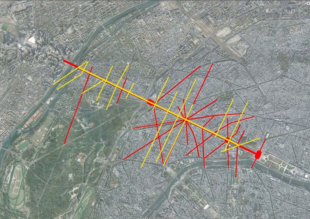
The size and network relationships are quite similar. The major difference is really that Paris is largely designed in the Baroque radial pattern of streets making direct connections between important points. Compare that to the more rectilinear pattern of historic Dallas (only interrupted where modern traffic engineers disrupted the grid for suburban-style streets).
Anybody who has ever stepped foot in Dallas knows of the North-South divide. And we quickly point at I-30 as the Maginot line between the two. Whereas highways will never fully be breached (as long as they exist) urban boulevards, provided they’re designed appropriately can and should provide the seam between disparate parts.


