Hi. I’m a city of almost an identical population to the Big D. Except the populous has organized itself on much less land, allowing plenty of agricultural production within the city boundaries. Because of this, during any potential disruptions in global food production, I’ll be able to meet many of my citizens’ most basic needs.

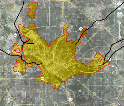
[Populated areas overlaid on Dallas – Highways in Black]
Highways, as we know them, barely exist within the city, only enough to bring people to the city (macro to macro), before turning to appropriately scaled boulevards and lesser hierarchies (all of which are heavily tree-lined) for the local economy, to connect micro destinations to micro.
Like the earliest portions of Dallas, much of the city is arranged in rigid orthogonal grids intersecting each other at different angles. Each sub-district is punctuated by interconnected “Savannah-like” squares named after silly notions like Liberty, Independence, and Constitution. Silly Wabbits. The interconnection of these squares w/ important public buildings situated on them, create for a strong axial hierarchy within the city center.
What City am I?