If you were paying attention to Wednesday’s city council meeting, the city approved a proposed Thoroughfare Plan amendment to approve the conversion of Tyler and Polk Streets from one-way to two-way traffic. While much of the dialogue about converting one-ways to two-ways has rightly been about inappropriate and unsafe speeds through neighborhoods and the improved access of two-way streets for businesses since slower, two-way traffic means more direct access from both directions and the improved visibility from slower speed. Since the couplet runs through both neighborhoods with residential frontage and commercial nodes where the couplets cross Davis and Jefferson, the two-way conversion is context sensitive for both conditions.
While these issues are becoming increasingly understood, what I want to write a bit about is not just about the trouble the one-ways create from a cross-sectional perspective and how they relate to their building frontages, but the trouble that one-way couplets have reintegrating with the grid.
It’s also critical to understand no two one-ways are the same, they have to be understood within their context. I’ve heard people write or say that one-ways work just fine in New York or Portland (and I’ll throw Center City Philadelphia in as well). However, in each of these three cities the one-ways start and end at intersections within a dense, highly interconnected grid. There is no merging of the couplet as I’ll be showing below. But those cities also have very specific conditions that allow the one-ways to work. New York has hyper density. Portland has tiny blocks, only 220′ x 220′ so the access issue is less problematic and the sheer amount of intersections created by a 220 x 220 grid means plenty of intersections to calm traffic (which is another issue I’ll be touching on). Center City Philly has tiny streets, ranging from 10′ to 26′ curb-to-curb. They’re just too small to fit two-way traffic plus parking plus bike lanes on some corridors.
You’ll notice the one thing each of those three cities have in common is a highly connected rectilinear grid that allows for an abundance of route choice, adaptability for wayfinding, and flexibility for transportation planners to have a variety of different corridor types that make the same connection. Highly interconnected grids connect everywhere to everywhere rather than Point A to Point B, which seems to have been (and often continues to be) the prevailing mindset in Dallas transportation planning.
How do we connect this one point to this other point? Oh, well we just plow this road directly through there. That’s the wrong thing to do, assuming a singular direct connection at the expense of overall grid connectivity has a positive impact on mobility or accessibility. Instead, it has a negative impact on all of these aspects.
The mindset is that vehicular throughput trumps all other considerations. If we’re moving cars fast and furiously, everything is better. Business does better, congestion is magically solved, and a pony for all the children. The problem is that business does not do better and congestion is created because instead of the grid filtering traffic, the mindset of corridor throughput funnels more traffic into one corridor. The result is often bipolar. Streets are either invaded by cars or abandoned entirely and the entire corridor slips into dysfunction as the street, as public good, is no longer doing its job of facilitating social and economic exchange.
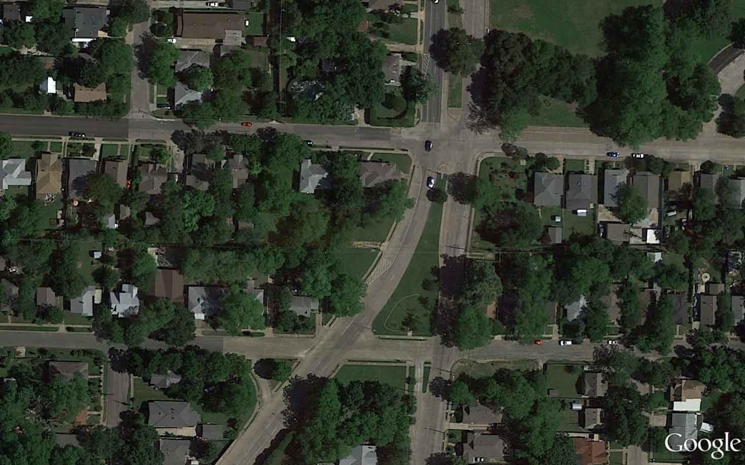
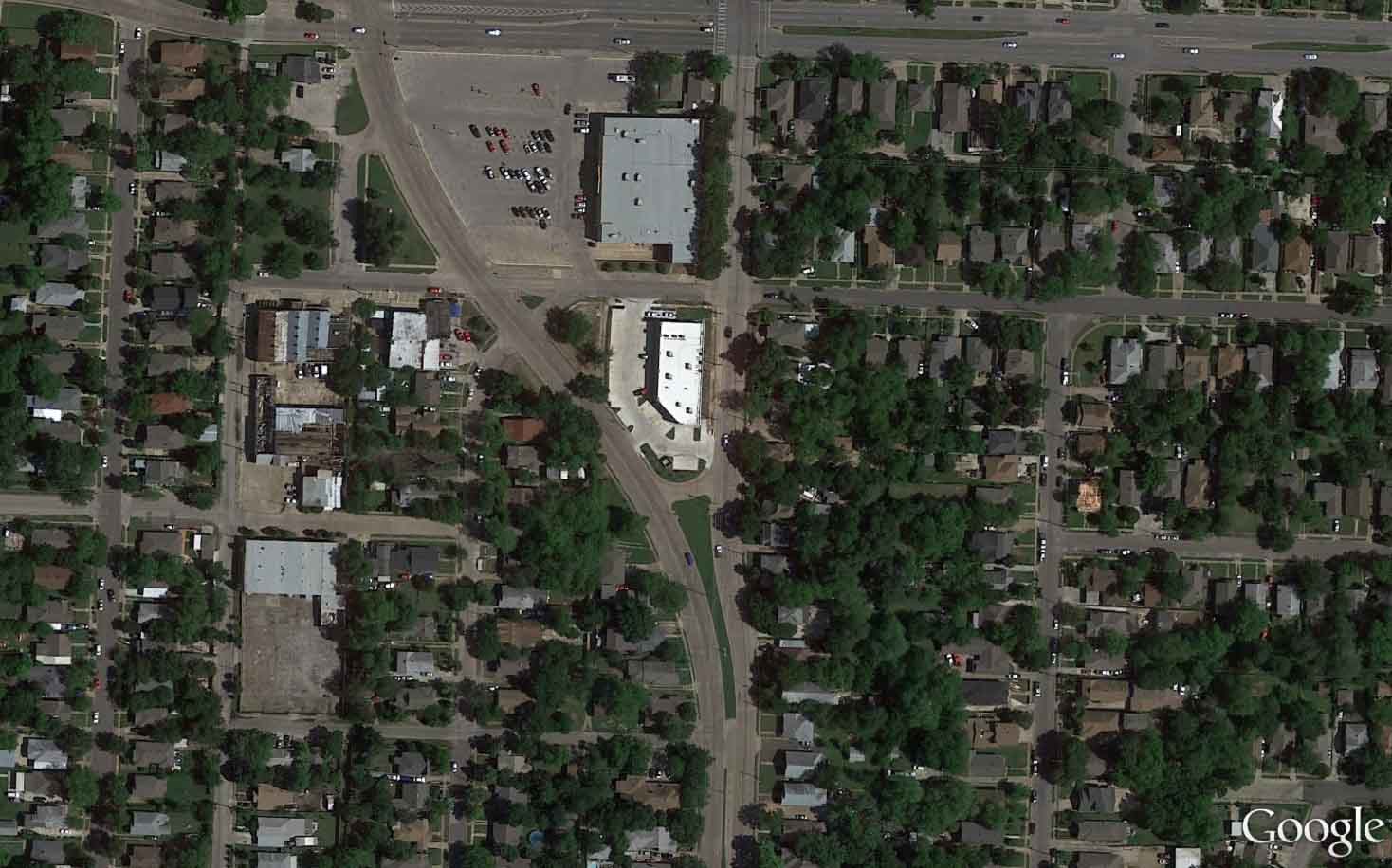
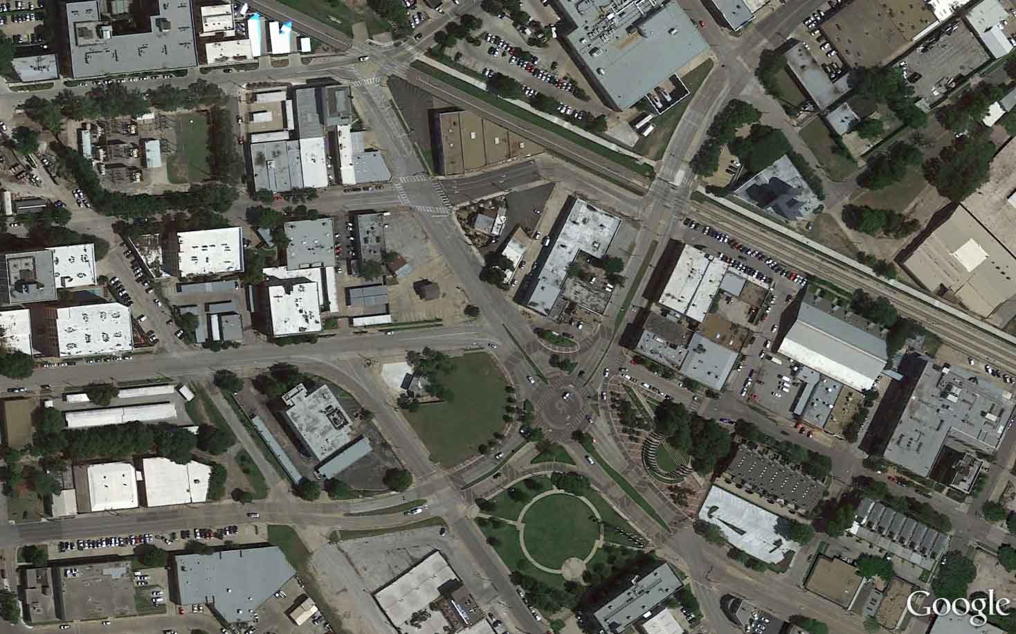
Below you will find several of the one-way couplets around town and the lengths we went to in the 1970’s to try and make these alien life forms blend back into the two-way grid.
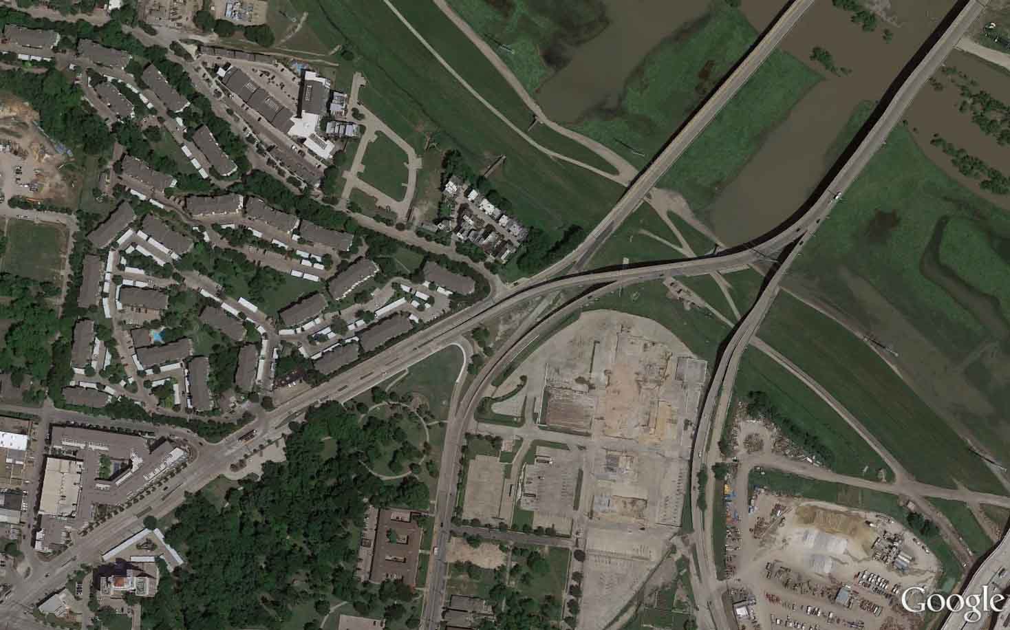
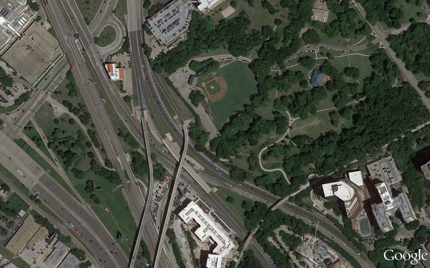
Why nobody can ever ever ever ever ever visit Reverchon Park.
I show this one last because it may be the worst, though they’re all bad. They deteriorate their surroundings and I shudder to think about how many homes and businesses were condemned in order to realize a traffic planning snuff fetish fantasy. These designs misunderstand the basic role of intersections within cities. The first clue is all of those free right turns that undermine the function of intersections and kill pedestrians for good measure (or at least scare them away). This design is about cars first, pedestrians are a nuisance. Pedestrians spend money. Vehicles cause mayhem. You get what you pay for.
They’re not about facilitating throughput based on road hierarchies, but instead about Convergence (in micro-) and Dispersal of traffic (in macro-). That may sound like they are in contrast, but it is that tension that holds cities together and helps them function. That’s why intersection density is a key metric in understanding which and why certain neighborhoods and cities succeed or fail. Intersections aggregate the good (pedestrian activity) based on the quality of spaces and businesses and quantity of pedestrians attracted to it. Intersections in highly connected systems also disperse the bad, vehicular congestion.
There is also the balance between the public realm and the private, fundamental to cities. The public realm provides the interconnectivity and the access for social and economic exchange that is provided for by the interface between public and private realms, where commerce and economic growth occurs. There is a quote I once found in the 1912 Plan for St. Louis that I quite like, “The role of the public realm is to maximize the productivity of the private realm.” This may sound cynical in a corrupt way, but when you apply that thesis to infrastructure design it makes sense. You’re doing something wrong if you’re extracting value from private property, devaluing land. Similarly, if you’re overextending infrastructure through sprawl, you are cannibalizing from other areas. And if you’re maximizing value and productivity of private property, you’ll receive the windfall of tax base which maintains everything and provides amenity over top of the base line maintenance.
This is the fundamental logical shift that has to accompany the phase shift from a car-centric city of vehicular congestion to a multi-modal, highly livable and desirable city of walkable, interconnected neighborhoods. It’s not just about the cross-section of the corridor, even though that’s what Thoroughfare Plans are concerned with, it’s also about the big picture of overall grid functionality and the new paradigm. Sometimes it’s best to throw out the old in order to bring in the new (which oddly is much closer to the old(er), before this failed experiment in auto-centric city-building.