Streetcar is coming. Streetcar is coming!
I’m sure most of the regular readers of this site have heard the good news. Dallas won a federal TIGER (transportation initiative) grant for $23 million to start design and construction of the proposed 1st phase of the modern street car line. The second piece of good news, is that it is actually going to be one of benefit rather than the tourist trap downtown loop initally proposed. The flip side of this story, is that while the application was pursued in concert with Fort Worth, the federal government took it upon themselves to extricate Fort Worth from the receipt.
There has been some speculation that red Tarrant county was victim of some partisan politics from the Feds. First, whenever I see the victim card played, typically red flags go up in my head. Before we start getting all conspiracy theory, let’s remember that between the high speed rail and TIGER grants, that some of the biggest winners have been states with Republican governors. So without cynicism, perhaps we might find other reasons for Fort Worth being left out…like the feds might have some concern that Fort Worth is double-dipping with multiple applications (ie the New Starts Grant later this year)? That is just a guess, but one that I think might be a little more logical.
It is a setback, but ultimately one more of timing and inconvenience than anything else. The shame of it is, that in my opinion the area of Fort Worth due to get the early phase streetcar is more lined up for immediate real estate investment. This is where the real value of streetcar is found, ROI. I’ll have more on this later, but first think about the kind of returns via private investment Portland ($2.5 billion) and Tampa ($900 million) talk about with their streetcar lines. And Tampa did virtually everything wrong!
So maybe there is hope for us when we begin to get off the rails (pun rather intentional)…
————————–
For the uninitiated, the first question one might ask is, “more streetcars?! Like that old-timey trolley thingy on McKinney Avenue? In fact, no. These will be sleek, quiet, comfortable low-floor, accessibly loading modern streetcars. And, I’m told that they will be purchased domestically from a company in Portland (rather than the Siemens cars), so I don’t have to spend time belly-aching about bailing out Ford to build more stuff that we don’t need rather than overhauling plants to build that which we will.
As freeways were the way to the future for the baby boomer generation, making the streetcar “of its time.” Anything resembling nostalgia will limit its potential and reach towards the new population bubble, the Millennials.
Beyond style or preference, I find that the contemporary if not almost futurisitc look is an important indicator of progress to the public at-large. It is a subtle, but important message for building support that the City of Dallas is serious about building a great city rather than any feeble attempts at freezing people in time like a ride at Disney. This isn’t about tourists, it is inclusive, but primarily for residents (the significance of which I will explain in a bit).
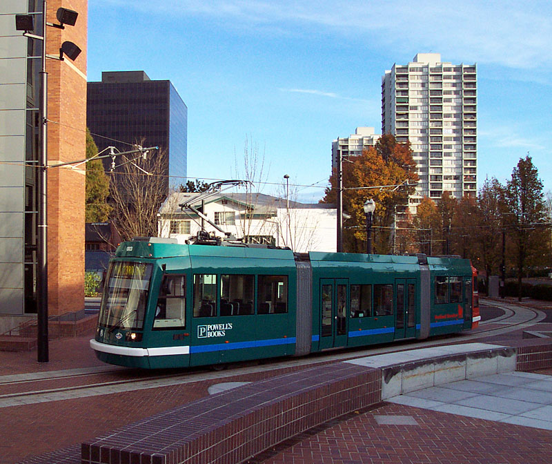
I expect them to look more like these Portland cars…
But, it is fun to check out what some other cities have:

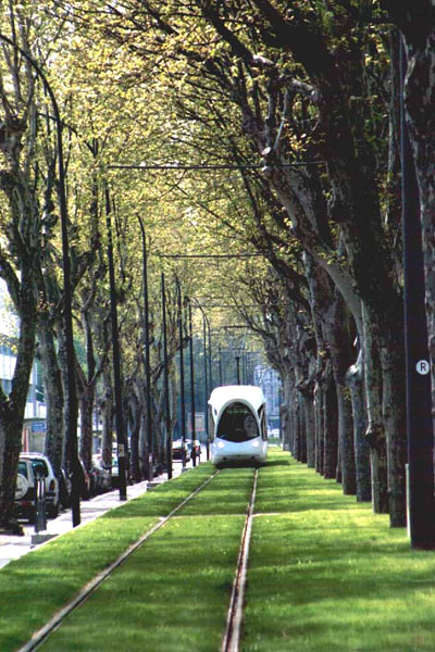
Lyon
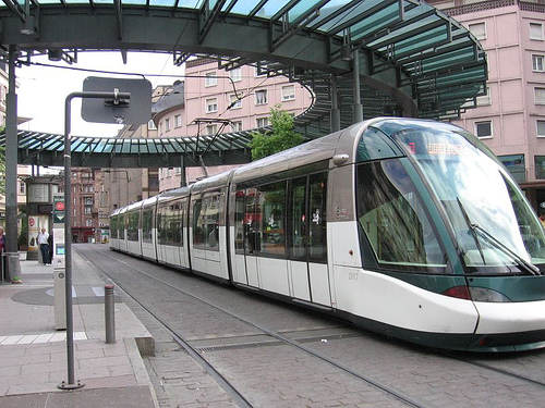
Strasbourg
Your second question might be, “what can this possibly do for me?” First, why turn your nose up at $23 million dollars from the Federal government that isn’t going towards highway expansion (although as part of the TIGER grants, somehow something called “innovative highways” [guffaw] received funding including a highway expansion in Dallas. I guess being second in highway lanes per mile just isn’t good enough. Kansas City, don’t you know everything MUST be bigger in Texas, for better or worse – we make no qualitative distinction, or lest we consider ourselves failures and frankly, we just can’t live with that.).
Public transportation can often be a lightning rod because of its relatively high upfront costs and seemingly low revenue generation. It is important to remember that no form of transportation on the history of the planet was ever “profitable” in and of itself. Even for me to ride a bike to the new bowling alley bar in Deep Ellum this Summer requires 1) cost to buy the bike, and 2) energy, ie calories. I have to eat a powerbar to expend the energy to get to my destination. Yet, it seems free, just like it does to hop on the highway and drive to Walmart. The true costs have been “unbundled,” so the average person has no idea how much they’ve been screwed over by the automobile monoculture.
The primary purpose of transportation is to facilitate the functions of city (the transaction of human needs/wants), as Mumford states, “to concentrate the greatest variety of goods and people within that limited area, in order to widen the possibility of choice without making it necessary to travel. A good transportation system minimizes unnecessary transportation; and in any event, it offers change of speed and mode to fit a diversity of human purposes.”
Car monoculture dislocates these operational efficiencies and have since, as predicted, proven a failure fiscally, environmentally, economically, socially, and medically.
Second, is that streetcars by nature encourage density (eek density! Arm yourselves with crosses and garlic!) and density pays the bills; it requires less infrastructure per capita lessening the tax burden on everyone. This is the ROI that I spoke of regarding streetcars and transportation in general.
Here is where I say, “this is how transportation should always be thought of, but never is.” Except that I am not too naive to understand that it is FAR too easy to externalize certain factors/costs, and convince people that a new highway is actually a good expenditure. The question you have to ask people then really comes down to, how do you want to live, how do you want your city to look?
Third, the streetcars will help to lessen the burden on downtown parking for workers, as streetcar is best suited for short- to intermediate-range commuters. Less demand, with all that supply (OMG ALL THAT SUPPLY) could mean lower costs for parking for commuters into downtown. Though, that is a very slippery slope into circularity of argument.
Fourth, streetcars help lead to safe, interesting, vibrant areas – with unique restaurants and experiences. Note that I didn’t say “will.” The implication being that streetcars are some magic bullet for livable cities. They are one in a kit of parts. As I’ve said before, if it isn’t part of a chicken/egg dilemma, you probably aren’t on the right track toward building more livable cities.
See McKinney Avenue. It took the state’s first TIF, will of city leadership/stewardship, and private developers willing to take a monumental risk so big that they had to go oversees to find lending for projects in what was one of the worst areas of the City 20-30 years ago. Now we have things like Crooked Tree coffeehouse, the prototypical third place/hole in the wall, offering character while indicating a mature, resilient, complete neighborhood. (Yes, I shamelessly plug my favorite spots in the City: those that are local, embedded in their community, friendly staff, and full of character.)
These were the first suburbs and you still see the vestigial remnants of the emergent city forms in Lakewood and Bishop Arts. The underlying forces dictating these efforts were not unlike what continued to happen building further suburbia. The difference however, is that the streetcar suburb was still walkable, it still had a functional urban form, and a workable and predictable hierarchy imposed by the permanence of a fixed-line transportation element where the singular dominance of the automobile and its infrastructure diffused people, spaces, and buildings into “anti-city” where each component not only no longer communicated with the other elements of the urban equation, it now ignored them. Anti-city meant anti-economy.
Not coincidentally, streetcars are logically seen as one of the items to help restore the areas they helped to create one hundred years ago. In the modern megalopolis, each region of the city needs to have the appropriate scales of transportation to serve it in relation to its context. Streetcars typically serve areas within 1/2 and 3 miles of the primary convergence point, core or destination, typically a job center, ie downtown. These are the areas that have become blighted and desolate for the most part, and now have the potential to go from 0 to 60 as fast if not faster than did uptown Dallas because they will be swimming with the tide rather than against what is considered “conventional.”
While I think a case can be made for Ross Avenue or Deep Ellum to get the first line, I think it is 1) important politically to address South Dallas and 2) Oak Cliff already has a more robust and defined character that makes the area ripe for success. The goal will be to allow that almost Austin-like [ducks] funkiness to remain under the extreme pressure of investment and new development. Some might call this gentrification, others investment. Either way, it is another engine that must be harnassed to maximize value (of all kinds).
———————————
The plan, as stated in the TIGER award, starts at Main Street Garden at Harwood and Main, head west down Main Street to the West End, hang a left on Houston to Union Station, where it will then cross the Trinity into Oak Cliff. The summarized submission then gets a bit vague stating that it will stop at Methodist Hospital before servicing several neighborhoods. I’m guessing if there will be budget cuts, these neighborhoods are what get expanded to at a later date.
Looking conceptually at how streetcars can strategically reposition areas of Dallas, it helps to establish goals. Mine would be to catalyze reinvestment in the form of high quality walkable urbanism in the districts/corridors shown below. These would all be immediately adjacent to downtown, would create for the kind of urban housing that is proving difficult in downtown, and thus be mutually supportive of downtown Dallas. If I were to prioritize these areas based on need of immediate investment (desperation), readiness (somewhat subjective), and potential for future buildout (or what is the ceiling/highest and best use for this area?), it would be as follows:
1. Oak Cliff (between Bishop Arts and the Trinity)
2. Deep Ellum
2b. Ross Avenue to Lower Greenville
3. Cedars
4. Fort Worth Ave
5. Industrial Ave/Design District
6. Davis Street

New/Future DART Line in green. Katy Trail in yellow. Uptown area served by MATA in aqua.
So if we add in the new phase, and stop it at Zang and Davis to save approximately $20 million/mile while still serving Methodist Area and being a 1/4-mile within Bishop Arts, I think this would be logical. There might be some desire to loop it back on Beckley, but as I’ll get into, I would avoid “loops” in favor of Y- or T-turnarounds in a parking lot if the rights can be had.
Rather than building loops, the next couple phases should focus on extending lines through downtown to the other areas in need of transportation alternatives and private investment. This would minimize transfer between lines to (typically) one at most. If I’m on Lower Greenville and decide I want to pizza at Eno’s in Bishop Arts, if lines criss-cross, I can more predictably navigate my way on two lines max, rather than riding into downtown, catching the downtown circulator to some stop that I might not be sure of to catch the car heading towards Oak Cliff. Amount of transfers can be a mental barrier and should not be underestimated in terms of how it effects ridership.
This expansion consists of probably three phases. The first that I would execute would be to extend the MATA to Main Street meeting the new line, which would simultaneously be extended into Deep Ellum, thus directly linking Bishop Arts and Deep Ellum on one line. The next phase would take a radius line from the Arts District on Ross to Lower Greenville.
Eventually, the MATA/uptown line that is now extended to Main Street would continue down St. Paul to Old City Park and into the Cedars. If you look closely (or click to embiggen) I included several graphics along with this line. The first that I would like to discuss is the questionmark within the Cedars loop. As I said earlier I don’t care for one-way loops. Maintaining both directions within one right-of-way creates for more predictability and “convergence,” which is necessary for commercial or mixed-use areas. This also allows for movement all on one-track with switch points at stopping areas for cars in different directions to pass. This can be cheaper but difficult to design.
Also, one-way loops makes permanent one-way roads. We may not be ready for them now, but we might some day. And, in fact I would call it a priority to start thinking of all downtown roads as places rather than escape routes (link to highway as agent of disinvestment) and begin converting them to two-way streets. If you know me, you know that I often stress flexibility and adaptability, as none of us is clairvoyant enough to design for 2050 issues, but we can allow for the ability of those who are living in them.
The Cedars however, and areas like it that exist essentially as peninsulas, it will be primarily residential with some smaller scaled-neighborhood support type functions rather than any kind of high intensity mixed-use or commercial that you might see along Ross, Davis, or in Downtown.
Furthermore, in residential areas, you want to get as close to the residents (in this case even the hypothetical ones) as possible. With streetcar, the catchment area may only be 1/4-mile and with the dimension of the Cedars it makes sense to loop the track on Corinth, Lamar, and then Cadiz back to St.Paul (as shown). This would reposition the maximum amount of city blocks for redevelopment/improvement.
At Woodall Rogers, you will see a red “X” and a green blob. The red X would represent the cleaning up or “context-sensitizing” of R L Thornton through downtown. Cloverleafs are a property value killer and highly inefficient use of land that should be much too valuable for a spacious on/off ramp. These should be cleaned up. The green blob would be a new deck park (ya know, provided any/all of these highways go away as they should) over the freeway. This repositions the south side of the convention center (to help alleviate the gigantic barrier that the CC is) as potentially new office development and the North side of the Cedars as higher density residential/mixed-use on the park. This part of the street car phase then would complete a loop between Main Street Garden, Old City Park, and a new deck park.
