
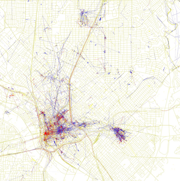

Oakland-based computer programmer Eric Fischer was interested in how locals see their city as opposed to how tourists see it. So, using publicly available data from the online photo-sharing services Flickr and Picasa, he mapped the photos taken by the two groups in various cities around the world. The map of Dallas you see here shows where geo-tagged pictures were taken over the course of two years. Blue points on the map represent pictures taken by locals (people who have taken pictures in Dallas dated over a range of a month or more). Red points represent pictures taken by tourists (people who seem to be a local of a different city and who took pictures in Dallas for less than a month). Yellow points represent pictures for which it was impossible to determine whether photographer was a visitor or a local. It seems from Fischer’s work that the hometown team likes Fair Park (bottom center blue cluster) and the Arboretum (top right), while visitors seem pretty focused on Dealey Plaza (the red on the left edge of downtown).
Related Articles

Arts & Entertainment
Dallas College is Celebrating Student Work for Arts Month
The school will be providing students from a variety of programs a platform to share their work during its inaugural Design Week and a photography showcase at the Hilton Anatole.

Basketball
A Review of Some of the Shoes (And Performances) in Mavs-Clippers Game 1
An excuse to work out some feelings.

Home & Garden
Past in Present—A Professional Organizer Shows You How To Let Go
A guide to taming emotional clutter.