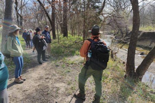
North Texas environmental health advocates and scientists from Texas A&M University have received funding to create a system that will allow the public to track air pollution similar to how they follow the weather forecast.
Texas A&M and the nonprofit Downwinders at Risk were last week awarded a $250,000 grant to pay for a computer model that can predict air pollution across the region down to the hour. The money comes from Google’s Environmental Justice Data Fund, which has a goal to fund programs that help improve the air quality of neighborhoods near industry.
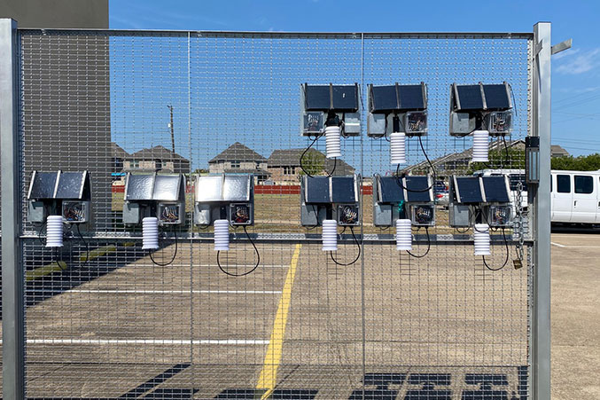
It’s an extension of the SharedAirDFW Network, an existing partnership with the University of Texas at Dallas, Paul Quinn College, the city of Plano, and Dallas County. That program started with eight strategically-placed air monitors that track air quality across neighborhoods in southern Dallas, Mesquite, Richardson, Fort Worth, and Plano. There are now more than 100 situated across North Texas.
The new initiative takes those goals to the next level. It involves mounting a “super-powered” gas analyzer to a vehicle that will drive through neighborhoods similar to how Google collects its Street View media. This so-called “mobile laboratory” will report back data to combine with the scientists’ modeling, delivering the public a mapped reading of dozens of pollutants found each day in communities in real time.
By 2024, the researchers hope to produce a five-to-seven-day air forecast as well as an hourly pollutant concentration map for the entire region. A forecast map with hourly information about air quality would be the first in Texas. A prototype version of the system was built in Houston, but the Dallas initiative’s ambitions for daily and weekly projections set it apart.
“It used to be large corporations or government agencies that could do this kind of thing,” said Jim Schermbeck, the director of Downwinders at Risk. “We are very excited about having the potential to do this because we think it will be a great way to identify new hotspots, new pollution hotspots, and possible new nonattainment areas for pollutants.”
He hopes that tracking air pollution in real-time, and by offering predictions, could shape environmental legislation within local and state governments. The organizers believe tracking the data is key to addressing environmental justice efforts for Black and Brown neighborhoods that have disproportionately been subjected to industrial polluters.
It will pair nicely with research from Paul Quinn College that mapped Dallas’ largest polluters and the city of Dallas’ investment in mobile air monitors, which have been placed near some industrial operators. Schermbeck sees the new system functioning as a critical piece of information in a fight against “racist zoning patterns that are still at play today.” Many studies have tied particulate matter air pollution to illnesses and diseases ranging from asthma to autism.
“We’re excited to build this new high-tech tool to map the accumulation of pollution many frontline residents know they’re breathing,” said Evelyn Mayo, the chair of Downwinders and the Urban Research Initiative Fellow at Paul Quinn. “This is a tool that’ll show who’s in harm’s way.”
Building the model is Dr. Qi Ying, a Texas A&M associate professor of civil and environmental engineering. He will use the U.S. Environmental Protection Agency’s modeling template as a baseline to estimate the concentration of 31 different forms of pollutants in the air. Dr. Natalie Johnson, an A&M associate professor and environmental toxicologist, will take the “mobile laboratory” on the road to calibrate the projection model’s accuracy in real time.
“This closes some of the giant gaps related to environmental justice issues with disparities in air quality,” Johnson said. “We will be able to work with fence-line communities to provide extremely detailed maps. And in the future, we will be able to look at how this is related to health and what it means in terms of informing the intervention around improved zoning and neighborhood planning.”
It will likely take two years before the system will be ready to use. It comes at an important time for local environmental policy. The city of Dallas is overhauling its land use plan, which advocates like Downwinders are pushing to include measures that will prevent industry from operating near homes and schools.
But Schermbeck also sees a more intimate way to use the technology: allow North Texas residents to make the healthiest choices for their families each day.
“There are all kinds of applications for this project,” Schermbeck said. “Like the monitoring, you don’t really see all of them when you start doing it. But they become clearer over time as people use the tool and the information becomes more relevant to people’s lives.”
Author