We spend a lot of time here ragging on DART, writing blog posts that link to maps and studies illustrating the failures of the North Texas transit agency and beating up on its cartoon character mascots. This is will mostly be one of those kinds of blog posts.
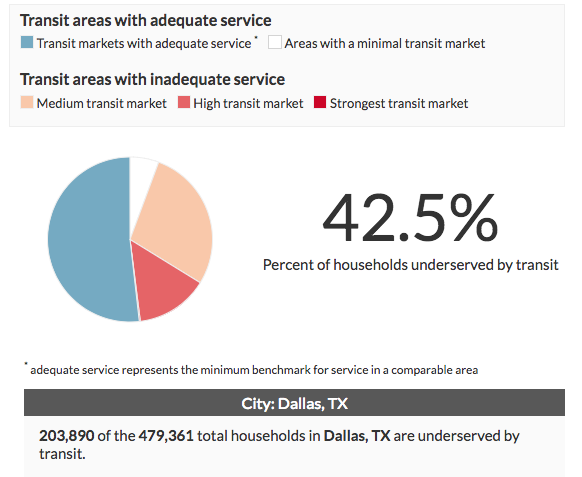
Because here we have a new online mapping tool, developed by the Center for Neighborhood Technology, that combines demographic information with public transportation schedules to point out gaps in American cities’ respective public transportation systems. It makes a point of highlighting urban neighborhoods where transit could be a major community asset, discounting those suburban and rural areas where public transportation is less likely to be used. Red, pink, and beige parts of the map are places where transit markets are underserved. The blue parts are where, by CNT’s admittedly flawed measure (we’ll get to that), transit markets have “adequate service.” The white parts are where there is little demand for transit in the first place.
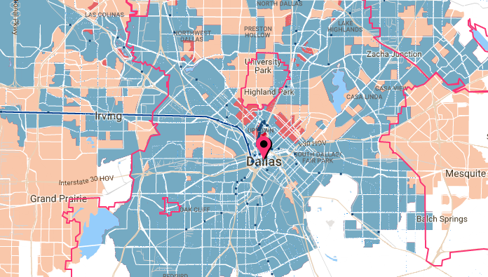
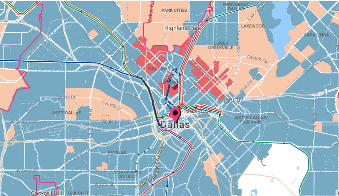
Let’s zoom in from the metropolitan area to Dallas’ core.
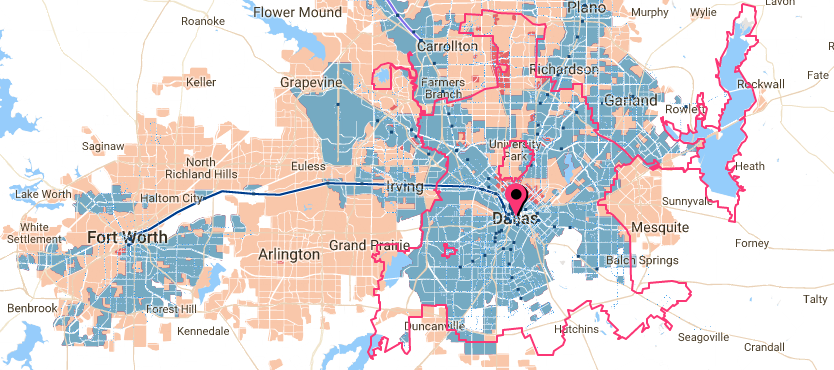
These maps are not perfect. Instead of using after-the-fact data and real-time traffic information, they pull from publicly available schedules. As anybody who’s missed a DART bus will tell you, those schedules are not always reliable. So public transit efficiency, something DART is notoriously bad at, is not factored in.
The maps account for density, but not for neighborhood walkability and mobility. That makes me question the map’s deep-red coloring in Uptown, a neighborhood that, compared to the rest of Dallas, seems well-served by options beyond the car. On the other hand, the map doesn’t account for obstacles to walkability, like, say, an elevated highway beneath which a walk from downtown to Deep Ellum is turned into a real-life game of Frogger, or a complete dearth of sidewalks in neighborhoods throughout the city. So some neighborhoods’ connections to public transit may actually get more credit than they deserve. And the map could be criticized for over-emphasizing market demand, rather than need: people in southeast Dallas who don’t have cars need to get to their jobs, too.
Regardless, it’s useful information for anyone thinking about communities suffering from a lack of quality public transit. (Coincidentally, the City Council this morning is being briefed on the development of a strategic mobility plan that would ideally address some of these issues.) And if you’re looking for another number to mutter under your breath when you’re sitting at an uncovered DART stop in the pouring rain, waiting on a bus that’s running 15 minutes late, it’s this: CNT estimates that more than 42 percent of households in Dallas are underserved by public transit. That’s nearly half of the city that can’t count on public transportation.