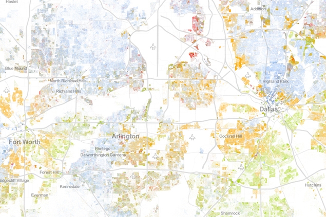
That there is a map that is part of a series Wired is calling “The Best Map Ever Made of America’s Racial Segregation.” For anyone familiar with the region, this map doesn’t really reveal anything we already didn’t know (the African American and Hispanic south and southwest; the homogenized north surrounded by minority enclaves like Vickery Meadow, Hamilton Park, Northwest Dallas). There are more interesting maps in the Wired collection (like this one, which illustrates just how much of a racial barrier 8 Mile Road is in Detroit). That said, what’s almost as startling as the visualization of latent segregation offered by the map, are the huge moats created by I30 and I35. If there was ever any doubt about the root cause of discontinuity in DFW, here’s visual proof, with the added bonus of seeing just how these undesirable highway barriers seem to impact geographical demographics. Also interesting is how intelligent the design of Central Expressway appears, just in terms of the way it avoids breaking up density. And you can also see in the map how the roots of Central’s design — a tool of aggressive segregationist development — still have a lingering impact on the demographic distribution north of downtown.